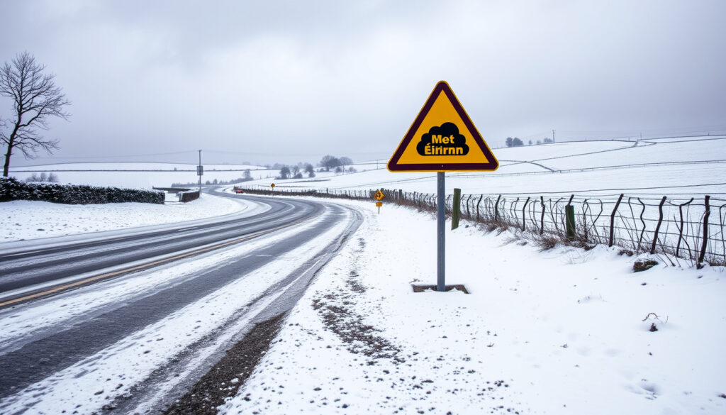
Moderate Snow Ice Warning: Meaning & Met Éireann Criteria
If you’ve ever checked the forecast and seen a “moderate snow and ice warning” flash across your screen, you probably wondered what that actually means for your commute, your school run, or your weekend plans. Met Éireann uses specific numerical thresholds—not vague language—to decide when you’ll need to dig out the winter coat and when you can leave the umbrella at home. This guide breaks down exactly what triggers each warning level, what the numbers mean on the ground, and how Ireland’s national weather service applies these criteria to keep you informed.
Snow/Ice Threshold: 3cm or more in 24 hours (Yellow); 3cm in 6 hours, 5cm in 12 hours, 10cm in 24 hours (Orange) · Low Temperature: Air minima of minus 3C or minus 4C over wide area (Yellow); minus 5C to minus 10C (Orange) · Danger Level 2: Moderate danger with icy conditions (Orange) · Red Warning Snow: 15cm or greater in 12 hours; 30cm or greater in 24 hours · Issuer: Met Éireann
Quick snapshot
- Met Éireann defines a Status Yellow snow/ice warning as 3cm or more accumulating within 24 hours (Met Éireann Warning System Explained)
- Status Orange (moderate) requires 3cm or greater in 6 hours, 5cm or greater in 12 hours, or 10cm or greater in 24 hours (Met Éireann Warning System Explained)
- These thresholds are guidelines—forecasters weigh severity and likelihood before issuing any warning (Met Éireann Warning System Explained)
- Whether Storm Erin or Garetti will produce snow significant enough to trigger an Orange warning remains uncertain (Anne Rabbitte TD)
- No public record of criteria updates since the April 2020 Severe Weather Chart was published (Met Éireann Severe Weather Chart PDF)
- Exact regional impacts vary by location and recent weather conditions—thresholds apply uniformly, but outcomes don’t (Met Éireann Warning System Explained)
- Most warnings cover a 60-hour forecast window, extendable for weekends and holidays when confidence is high (Anne Rabbitte TD)
- Weather Advisories can reach beyond 48 hours for early awareness of developing situations (Met Éireann Weather Warnings Explained)
- Check Met Éireann warnings page for the latest Ireland-wide forecast before making travel plans
- Orange-level events typically bring infrequent, dangerous, or disruptive weather requiring preparedness (Met Éireann Weather Warnings Explained)
These key parameters summarise the official thresholds Met Éireann uses to classify each warning level for snow and ice events.
| Label | Value |
|---|---|
| Warning Authority | Met Éireann |
| Moderate Snow Threshold | 3cm in 24 hours (Yellow); 3cm in 6 hours, 5cm in 12 hours, 10cm in 24 hours (Orange) |
| Ice Risk | Minus 3C to minus 4C minima (Yellow); minus 5C to minus 10C (Orange) |
| Danger Scale | Level 2 moderate (Orange) |
| Current Check | www.met.ie/warnings-tomorrow.html |
What does moderate snow and ice warning mean?
A “moderate snow and ice warning” from Met Éireann corresponds to their Status Orange alert level—the middle tier in a three-colour system that also includes Yellow (low) and Red (high). Status Orange sits at level 2 on Met Éireann’s severity scale and signals weather that could significantly impact people, property, and daily activity across an area (Met Éireann Weather Warnings Explained). Unlike Yellow warnings, which target only those at specific risk due to location or activity, an Orange warning means the general population should prepare for genuine disruption.
Criteria from Met Éireann
The official thresholds for Status Orange snow/ice warnings break down into two categories: accumulation and temperature. For snowfall, Met Éireann looks at how much snow falls within a specific timeframe: 3cm or greater in 6 hours, 5cm or greater in 12 hours, or 10cm or greater in 24 hours all trigger Orange criteria (Met Éireann Warning System Explained). This tiered approach means a rapid burst of snow can justify Orange status even if the total 24-hour accumulation stays moderate.
For ice and low-temperature events, Orange kicks in when air minima reach minus 5C to minus 10C over a wide area, creating dangerous surfaces due to ice, snow, or freezing rain. The situation is described as stable—unlike Red events, which threaten to worsen (Met Éireann Severe Weather Chart PDF). Ground temperatures can run as much as 10 degrees lower than air temperatures, meaning icy patches may form even when your thermometer reads marginally above freezing.
Risks involved
Met Éireann emphasises that numerical thresholds are strong guidelines rather than rigid triggers. Forecasters weigh severity and likelihood, and impacts from wind, rain, or snow vary depending on location, recent weather conditions, the state of the ground, the time of year, and the duration of the event (Met Éireann Warning System Explained). A late-autumn snowfall on warm ground behaves differently than the same amount of snow falling onto frozen earth in January.
Is moderate snow a lot of snow?
Whether 3cm of snow feels like “a lot” depends on perspective and context. In Ireland, where heavy snowfall is relatively uncommon, even modest accumulations can disrupt transport networks, close schools, and create hazardous walking conditions. Met Éireann classes moderate snow as anything from 3cm in 6 hours upward—enough to lay down a visible covering but far short of the blizzard-level 10cm in 6 hours required for Red status.
Snow classifications
The classification system uses speed of accumulation as its primary differentiator. At Status Yellow level (3cm or more in 24 hours), the snow falls slowly enough that most daily routines continue with minor adjustments. At Status Orange, the faster pace—3cm in just 6 hours—means snow accumulates noticeably faster than it melts, leading to building snowdrifts and untreated surfaces becoming hazardous (Met Éireann Severe Weather Chart PDF). At Red level, 10cm or greater in 6 hours represents a genuine emergency snowfall rate.
Comparison to other levels
The three-tier system creates clear escalations. Status Yellow (3cm/24hr) indicates not unusual weather with localised danger—mainly a heads-up for those at risk. Status Orange (3cm/6hr up to 10cm/24hr) signals infrequent, dangerous, or disruptive weather that requires preparation. Status Red (10cm/6hr up to 30cm/24hr) indicates rare, extremely dangerous or destructive weather demanding immediate action to protect yourself and your property (Met Éireann Weather Warnings Explained).
For Irish conditions specifically, even “moderate” snow at Orange level represents meaningful disruption because infrastructure and public transport are not routinely equipped for heavy snowfall. What counts as mild inconvenience in Scandinavia can mean gridlock on Irish roads.
What are current snow ice warnings in Ireland?
To check the live status of any current or upcoming snow and ice warnings affecting Ireland, Met Éireann maintains a dedicated warnings page that updates throughout the day. Weather advisories can be issued for conditions expected beyond the standard 48-hour window when confidence in the forecast is high—particularly for weekend or holiday periods when people need more notice to plan activities.
Warnings today
Current warnings are published on Met Éireann warnings page with a map showing affected counties and the precise warning criteria in effect. Met Éireann typically issues warnings for weather anticipated within a 60-hour period, with forecaster judgement determining the exact timing and severity (Met Éireann Warning System Explained). When a snow or ice event is developing beyond that horizon, a Weather Advisory may be published first to give early awareness.
Warnings tomorrow
The warnings-tomorrow page shows forecasts extending roughly 24-48 hours ahead, with specific accumulation thresholds and temperature minima displayed for each active alert. Users can also sign up for email and SMS alerts to receive notifications when warnings are issued, upgraded, or lifted. This is particularly useful for anyone with travel plans, outdoor work commitments, or responsibilities for school closures.
Met Éireann (Ireland’s official meteorological service) issues warnings based on impact potential, not just raw numbers. A Status Orange snow warning for Dublin carries different implications than the same warning for rural Connemara—traffic volumes, road salting resources, and public transport capacity all factor into real-world outcomes even when the snow depth is identical.
What do red and orange weather warnings mean?
The colour-coded warning system serves as a shared language between Met Éireann and the public, communicating risk level at a glance. While Orange (moderate) warnings warrant careful preparation, Red (severe) warnings represent a different order of magnitude—warnings that most Irish residents will experience only a handful of times in their lives.
Red criteria
For a Status Red snow/ice warning, the thresholds more than double those of Orange. Snow must accumulate at 10cm or greater in 6 hours, 15cm or greater in 12 hours, or 30cm or greater in 24 hours to trigger Red status (Met Éireann Warning System Explained). For extreme cold events, Red requires air minima of minus 10C or below sustained for three consecutive nights or more, with daytime maxima not rising above minus 2C. Crucially, the situation is described as likely to worsen—a Red warning means conditions are expected to deteriorate, not stabilise.
Orange differences
The key differences between Orange and Red break down to accumulation speed, temperature severity, and trajectory. Orange snow events deliver 3-5cm per 6-hour window; Red events require 10cm or more in the same timeframe. Orange cold events sit at minus 5C to minus 10C and are described as stable; Red cold events plunge to minus 10C or below for multiple nights and are expected to worsen (Met Éireann Severe Weather Chart PDF). In practice, this means an Orange warning is a signal to prepare; a Red warning is a signal to act and avoid non-essential movement.
The gap between Orange and Red thresholds is deliberately wide. Met Éireann reserves Red for genuinely rare events to avoid cry-wolf fatigue. The downside: when Red does arrive, the public may not be as primed to act as they would be in countries where Red warnings are issued more freely.
The implication is that Orange warnings demand proactive preparation rather than reactive crisis management.
What is moderate coastal event warning?
While snow and ice warnings dominate winter forecasts, Met Éireann also issues a distinct category called “coastal event” warnings. These address marine hazards rather than inland conditions—typically combining strong winds, high seas, and storm surges that threaten coastal communities, ports, and maritime activity. A “moderate coastal event warning” sits at Status Orange level within that specific category, indicating conditions that could significantly impact coastal areas without reaching the destructive intensity of a Red coastal event.
Meaning and criteria
Moderate coastal event warnings are issued when a combination of offshore wind speeds, wave heights, and tidal conditions creates elevated risk for coastal flooding, erosion, or damage to infrastructure. The specific criteria vary depending on the vulnerability of different coastlines—exposed Atlantic shores face different thresholds than the more sheltered eastern coast. These warnings often overlap with Orange or Red warnings for wind or rain, creating compound weather events that amplify each other’s impacts.
“A status orange weather warning is given before expected weather conditions that could significantly impact people, property and activity in an area.”
— Siobhán Ryan, Meteorologist, Met Éireann (Met Éireann Weather Warnings Explained)
“These numerical criteria are strong guidelines but impacts from wind, rain, snow etc., vary depending on location, recent weather conditions, the state of ground, the time of year as well as the duration of the event.”
— Met Éireann Official Explanation (Met Éireann Warning System Explained)
For those planning coastal activities or with property near the shore, checking Met Éireann’s coastal warnings alongside inland forecasts provides a fuller picture of the weather challenges ahead. Snow may be absent, but coastal gales and surge conditions can be equally disruptive.
Related reading: BBC Weather Market Drayton · BBC Weather Market Drayton
Met Éireann’s moderate snow ice warning criteria build on insights into meaning impacts preparation, helping residents anticipate disruptions from 3cm accumulations.
Frequently asked questions
Who issues snow and ice warnings in Ireland?
Met Éireann, Ireland’s national meteorological service, is the official issuer of all weather warnings including snow and ice alerts. The service operates under the Department of Defence and provides forecasts and warnings for the entire Republic of Ireland.
How often are weather warnings updated?
Met Éireann updates warnings as conditions change, typically reviewing active warnings every few hours during an evolving weather event. The dedicated warnings page at met.ie shows the most current status and timestamps when each warning was issued or last modified.
What precautions should I take for a moderate snow warning?
For Status Orange snow/ice warnings, consider delaying or rescheduling non-essential travel, ensuring you have adequate food and medical supplies at home, checking on vulnerable neighbours, and keeping your car winter-ready with antifreeze, de-icer, and emergency provisions.
What’s the difference between snow warnings and ice warnings?
Snow warnings focus on accumulation thresholds—how much snow falls within specific time windows. Ice warnings focus on temperature minima and surface conditions, particularly dangerous icy patches from freezing rain or melting and refreezing. Met Éireann often combines both into a single snow/ice warning when conditions support both hazards.
Where can I check live Met Éireann warnings?
The official source is met.ie/warnings-tomorrow.html, which provides an interactive map and text descriptions of all active and upcoming warnings. The site also offers free email and SMS alert registration for those who want proactive notification.
Do warnings apply nationwide or to specific regions?
Warnings can be issued for the entire country or targeted to specific counties or regions depending on where hazardous conditions are expected. Met Éireann uses a county-by-county approach to ensure warnings are proportional to actual risk rather than over-alerting areas that won’t be affected.
What happens after a snow warning expires?
Once conditions improve below warning thresholds, Met Éireann will either allow the warning to lapse naturally or issue an updated warning if a new event is approaching. After a significant snow event, residual ice can persist for days even after the snowfall warning ends, particularly on untreated surfaces and shaded areas.
More related posts
 Sign In to Universal Credit: Official GOV.UK Guide
 18 Stone in Lbs – Exact Conversion Guide and Charts
 Roast Dinner Near Me: Top Sunday Roasts in Cork
 Class 2 National Insurance – Guide for Self-Employed 2025
 Ready or Not 2 – Film vs Game Status Explained
 How Much Is YouTube Premium UK – Prices and Plans 2024
 Man United New Stadium – Timeline Capacity and Plans